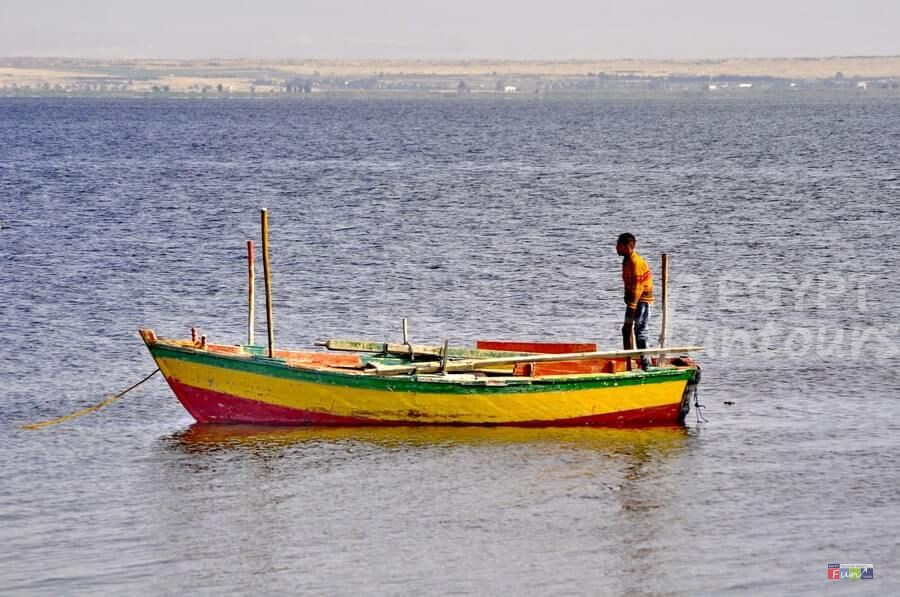
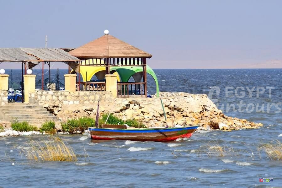
Qarun Lake National Park: Life, History, and Geography
Lake Qarun, some 80 kilometers southwest of Cairo in the Egyptian Fayoum region in the Nile Valley, is one of Egypt’s most prized natural monuments and a resource that has aided human civilization for over 8,000 years. It is Middle Egypt’s sole natural modern lake of any size. As a result, it is abundant in both natural and archaeological treasures.
Lake Qarun history
A Glimpse into Egypt’s Third-Biggest Lake
Lake Qarun is a vast and historic body of water and is Egypt’s third-largest lake, behind only Lake Nasser. Located in the northern part of the Fayoum depression, the lake lies 45 meters below sea level. Locals in Fayoum often say that you haven’t truly seen their region until you’ve visited the lake, which they simply call “Berka,” an Arabic word for “little lake.” Despite its name, the lake offers some of the most magnificent scenery in the area, and a boat trip on its waters is an unforgettable experience.
A large, saline body of water, Lake Qarun is unsuitable for drinking. While people inhabit the southern and eastern shores and use freshwater irrigation systems, the northern shore remains an untamed, barren desert that is difficult to access.
The Origin of the Name: Qarun
The name Qarun has a complex history with a few interesting theories. Some people believe the name comes from Karanis, a Greco-Roman city east of the lake. However, this theory is unlikely, as people knew the lake as Birka El Seid (“the lake of fishing”) some 800 years after Karanis was abandoned.
Another theory links the name to the Arabic word Qarn, which means “horn.” In 1820, E.W. Lane referred to the lake as Birka Qarn and claimed its name came from a small, horn-shaped peak on a central island. However, he was the only one to make this claim, as other travelers before and after him simply referred to the lake as Qarun.
The Most Popular Legend
The most widely accepted legend connects the lake and a nearby temple with a figure found in both the Bible (Numbers 16) and the Quran (al-Qasas 76).
-
In the Bible, people know him as Korah, a man who rebels against Moses. God swallows him and his family into the earth as a divine punishment.
-
In the Quran, it describes him as a man consumed by his wealth.
According to an Egyptian legend, this man, Qarun, could turn anything he touched into gold. Some people believe his fortune is still buried beneath the lake. He eventually met a similar fate to the biblical Korah. The ground swallowed him as punishment for his arrogance and greed.
In 1714, a Frenchman named Paul Lukas recorded a more detailed version of this legend. According to his Bedouin companions, a tyrannical ruler named Caron once controlled a fertile and prosperous land. Caron was so wicked that he used magic to bring about a great flood and a strong wind that buried the entire region in sand, turning it into a sterile desert. This story likely reflects the real-world desertification that occurred during the late Roman era due to poor local governance. It’s possible that Qarun was a particularly unpopular Roman governor or a mythical figure who represented the destructive nature of Roman administration in general. People likely added the biblical and Quranic connections later when they noticed the similarities.
The Modern-Day Lake
Today, Lake Qarun National Park covers an area of 214 square kilometers. The lake is 42 kilometers long and up to 9 kilometers wide. Its maximum depth is just over 8 meters. It receives about 370 million cubic meters of drainage water annually. A rapid evaporation rate means the lake would dry up in just two years if its water source were cut off.
This high evaporation rate has resulted in a salt concentration similar to seawater. The water’s salinity is roughly 34.5 parts per thousand, compared to the 34 to 37 parts per thousand of normal seawater. The eastern and southern parts of the lake, where two main canals bring in freshwater, are less saline.
A Look into the Past
The lake we see today is a fraction of its former size. Its history is a subject of much debate, with archaeological, historical, hydrological, and geological evidence all telling different parts of the story.
John Ball’s 1938 book, “Contributions to the Geography of Egypt,” provides a detailed history that people still largely consider accurate. According to Ball’s research, wind erosion initially formed the Fayoum Basin. Approximately 70,000 years ago, Nile floodwaters broke through a side gulley and filled the depression, creating a massive lake. Over time, the lake’s level fluctuated due to climate changes and shifts in the Nile’s course.
During the Old Kingdom, the lake may have receded. It may have reached a level of two meters below sea level. It also lost its open connection with the Nile. However, Amenemhat I re-flooded the lake during the 12th Dynasty. He expanded and deepened a canal. People now know this canal as Bahr Yousef (“Joseph’s Water”). He also built a five-kilometer embankment to regulate water flow. This reconnected the lake to the Nile. It also created a reservoir. The reservoir protected Lower Egypt from severe floods.
The lake, which the Greeks called Lake Moeris, remained at a high level until the early Ptolemaic period. Ptolemy II then began a large-scale land reclamation project, constructing a new barrage and sluices to control the water flow. The lake’s level was lowered to two meters below sea level, a process that took up to 30 years. This project reclaimed roughly 1,200 square kilometers of fertile land, leading to an agricultural boom and the establishment of new cities.
The Lake’s Decline
In late antiquity, the canals, including Bahr Yousef, became heavily silted. The reduced water flow led to a drop in the lake’s level and a rise in its salinity. By the 14th century, it was no longer possible to use the lake’s water for irrigation, and farming on the northern side of the lake had all but disappeared.
By the 19th century, the lake’s water level had dropped to about 40 meters below sea level. Since the 1890s, when the underground drainage slowed, the salt content has risen at a faster rate, causing most of the original freshwater fish species to die off. For the past century, the lake’s level has been carefully maintained at 45 meters below sea level. Today, Lake Qarun is a protected area and a national park.
Check the weather in Egypt.