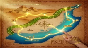
Detailed map of ancient Egypt under the Fatimid rule.

Egypt during the Fatimid authority saw several transformations and was under the jurisdiction of a succession of governors who reported to the caliph in Baghdad, Iraq, and served under the Fatimid rulers. Arabic became the official language of Egypt as a result of the Arabization movement that swept over the country.
Many great structures in Cairo, such as the Amr Ibn Alas Mosque, Al-Azhar Mosque, and Ahmed Ibn Tulun Mosque, were built by Egypt’s Fatimid Dynasty to increase tax revenues and to boost the government’s tax revenues. You can visit these structures as part of a Cairo day tour, as well as other great structures throughout the world.
Egypt’s map under Saladin Ayyubid’s reign.

As a result of commerce across the Red Sea, the Fatimid were able to establish a vast empire, which enabled Egypt to become a major hub for long-distance maritime trade between East and West. In the middle of the 12th century, a Turkish general by the name of Saladin, who dominated the nation in 1170 AD, built the magnificent Citadel of Cairo. Saladin also captured Jerusalem from the Crusaders in 1187 AD, and his successors continued to rule the city after him.
Mamluks were the rulers of ancient Egypt.
Map of ancient Egypt from the year 1453 AD.

During the reign of Saladin’s descendants, they surrounded themselves with Mamluqs, an army of Turkish slaves who, in 1453 AD, were able to take over the nation and even extend their control into Syria. Even under the Mamluks, Egypt continued to serve as the primary hub of Arabic civilization, and the Mamluks were successful in protecting the empire against the Mongol invasion in 1260. Mosques and bazaars, among other Islamic structures, were constructed during this period.
Map of Ancient Egypt during the Ottoman Empire’s reign.

After the Mamluks were defeated in 1648, the Ottomans took over as the ruling authority. After seizing power, the Ottoman Empire placed the Mamluk elite in a position of leadership to assist Egypt in its transition to a modern state of affairs.
They were able to contribute significantly to the administration of the province. Despite being marginalized by Egyptian culture and government, the Mamluks were able to establish themselves as essentially the sole rulers of the country during their reign. They defended Egypt’s southern border and maintained their respect for the Ottoman Empire’s authority throughout.
Map of Egypt under Muhammad Ali’s reign

In 1798 AD, European military forces rose to power, and the Ottoman Empire’s influence declined. The Ottoman Empire sent a Turkish general, Muhammad Ali Pasha, to control the country.
However, Muhammad Ali had other plans. By 1837 CE, he had established hundreds of schools and built a powerful Western army. He modernized the country and incited a revolt in Greece. He then took Syria from the Ottoman Empire.
Muhammad Ali wanted to expand his new kingdom beyond Egypt’s borders. He planned to depose the Ottoman ruler and take his place. In 1841, European forces compelled him to abandon his march on Constantinople and his claim to Syria. He had to settle for a new role: hereditary ruler of Egypt for himself and his descendants.
French engineers designed the Suez Canal, and Egyptian laborers built it over ten years. The British government supervised the project. The canal opened to the public in 1869.
Egypt’s map during the British Occupation of Egypt

Thousands of British troops invaded Egypt in 1914 to put down a nationalist uprising that was threatening the Suez Canal, as well as to fulfill a request from the country’s existing monarch, Ismail, to manage the country’s finances and preserve it from bankruptcy and complete anarchy.
Under Native Rule, Egypt Map 1960 AD

After World War II ended, the British government withdrew its troops from Egypt in 1947, keeping control of only the Suez Canal area. When King Farouk ascended to the throne, leaders reached an agreement on Egypt’s territorial boundaries. In 1952, under the leadership of Gamal Abdel Nasser, Egypt became a republic. Egypt gained control of the Suez Canal but suffered the consequences of British and French military actions on the Egyptian side of the waterway. In 1958, Egypt and Syria united to form the short-lived United Arab Republic.